send link to app
Clinometer Compass app for iPhone and iPad
“Clinometer Compass” is an an application used to measure geological survey, such as the strike and dip of the fault plane.
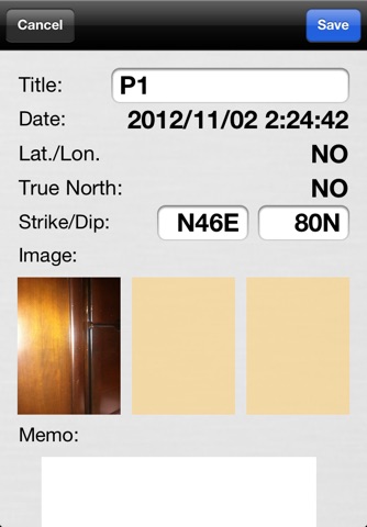
Measurement data can be stored easily, you can export in a csv file. You can record up to three pictures per one measuring point.
Features
•Stored data(Strike,Dip,Latitude,longitude,Date,Photos (up to 3),Memo)
•Measurement data export feature by iTunes File-sharing capabilities.
•Selectable measurement interval of angles(1,2,5 Degree).
•Add “Serial number” in the title.
•Add “Prefix” in the title.
Cautions
•Please use this apps at your own risk.


